Texas Water Safari 2025
June 13 - June 17, 2025 @ 201 San Marcos Springs Drive, San Marcos, TX, USA

COURSE MAP
Course Map
Go to www.texaswatersafari.org/course-map/
Weather
Below are local forcasts for several cities along the path of the San Marcos and Guadalupe rivers. Click on each for an extended forcast. Also, Weather Underground provides a weather map service that ties together, among (many) other things, radar, temerature, wind, and river flow.
San Marcos
Gonzales
Victoria
Seadrift
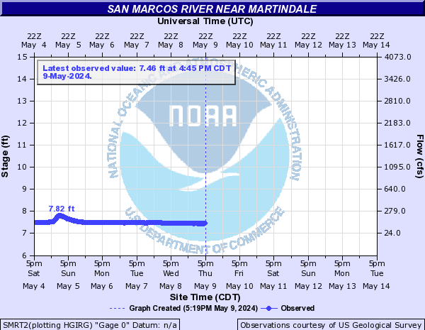
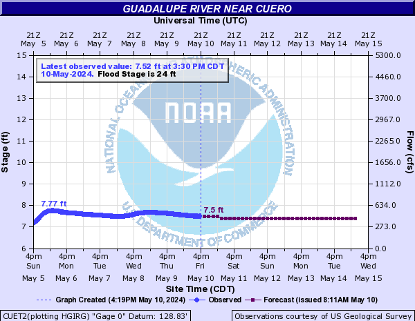
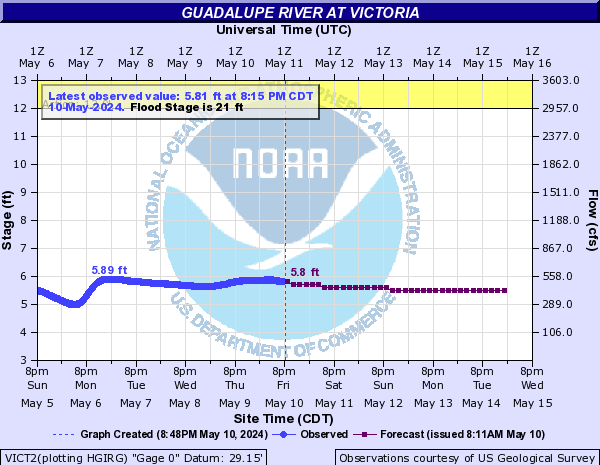
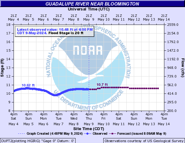
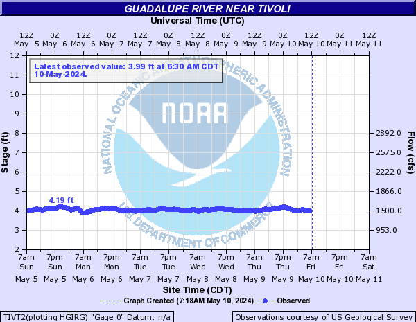
River Flow Data
Below are all the flow gauges on the San Marcos and Guadalupe rivers that are part of the Texas Water Safari course.


TEXAS Paddling Trails
For more information check out http://www.texaswatersafari.org/